1. At a Glance – Digital Twin Billion-Dollar Vision, Quarter-to-Quarter Reality Check
₹1,326 Cr market cap.
₹317 stock price.
30.7 P/E.
39.3% OPM (TTM).
₹147 Cr debt.
Promoter holding: 31.5%.
Return in 3 months: -30.5%.
Return in 1 year: -54.9%.
Welcome to Genesys International Corporation Ltd, the company that wants to digitally twin India’s cities… but just delivered Q3 FY26 EPS of ₹0.26.
Yes. Zero point two six.
Q3 FY26 (ended Dec 31, 2025) consolidated revenue came in at ₹86.90 Cr (as per press release), EBITDA ₹26.88 Cr, and PAT just ₹1.10 Cr — thanks to a ₹5.10 Cr exceptional labour liability. Quarterly profit declined ~75% YoY.
Meanwhile, the balance sheet has expanded to ₹920 Cr in total assets (Sep 2025), debt has climbed to ₹147 Cr, and debtor days are sitting at 261.
So here’s the question:
Is this a high-tech geospatial infrastructure play in the making?
Or a classic “great story, messy cash flow” IT services company?
Let’s zoom in. Satellite view activated. 📡
2. Introduction – From Cartography to Metaverse
If you still think Genesys makes “maps”, you are 2005 vintage.
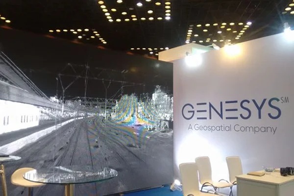
This company does photogrammetry, LiDAR mapping, remote sensing, cartography, 3D city models, ADAS navigation maps, and now… Digital Twins.
In 2021, NITI Aayog CEO Amitabh Kant launched the Genesys 3D Urban Digital Twin program. Big branding. Big ambition. The idea? Create a 3D digital infrastructure layer for urban India — utilities, telecom, planning, commerce, navigation, even metaverse-style urban simulation.
Sounds futuristic, right?
They also built India’s largest constellation of ground and aerial sensors to support this mapping ecosystem. And they raised serious capital — including a ₹110 Cr QIP in FY25.
But while the ambition is global, the financial performance is… volatile.
FY25 sales: ₹311 Cr.
TTM sales: ₹318 Cr.
TTM PAT: ₹39 Cr.
3-year profit growth: -3%.
TTM profit growth: -17%.
Exports were once 90% of revenue in FY20. By FY22, it dropped to 52%. Now the focus is urban India, telecom, and automotive.
They’ve signed contracts with Tata Motors for ADAS mapping. Won airport subsurface mapping orders. Secured Digital Twin city projects across India.
But here’s what matters:
Can they convert these “smart city” headlines into stable, recurring earnings?
Or will earnings keep behaving like a monsoon forecast?
3. Business Model – WTF Do They Even Do?
Let’s simplify.
Step 1: They Capture the World
Using:
- Aerial surveys
- LiDAR
- Ground sensors
- 3D scanning
- Remote sensing
They collect massive geospatial data.
Step 2: They Convert Data into Maps & 3D Models
This includes:
- Navigation maps
- Urban Digital Twins
- ADAS-ready automotive maps
- Telecom fiber management (Telescape platform)
- Subsurface mapping (GPR + LiDAR)
Step 3: They License & Deliver to Clients
Industries served:
- Urban development
- Telecom
- Utilities
- Infrastructure
- Automotive
- Airports
Recent contracts include:
- Tata Motors – 6-year Native Navigation & ADAS maps
- Adani airports – ₹17.38 Cr subsurface mapping
- Guwahati Digital Twin – ₹13 Cr
- Kochi Digital Twin – ₹9.13 Cr
- Land records modernization – ₹56 Cr